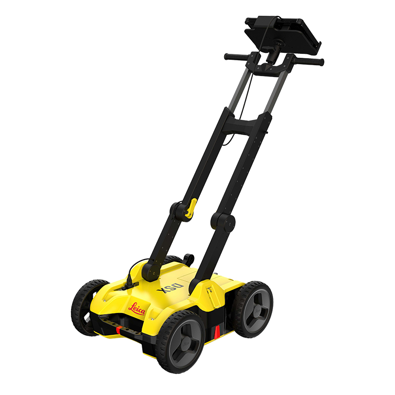
For utility repair and maintenance, civil engineering and surveying companies, the Leica DSX utility detection solution, consisting of a portable hardware with intuitive software allows to easily locate, visualise and map utilities. Unlike any other ground penetrating radar (GPR) system, the Leica DSX maximizes productivity with cutting-edge software that automates data analysis and creates a 3D utility map on the field.
Set Up Job / Quick Scan
Set the grid size according to your job’s need or start Quick Scan
Add different background layers, such as Google Maps or DXF/DWG
Data acquisition
See your scanning path and positioning accuracy in real-time for guidance.
Set point of interests, such as manholes, lamp posts or hydrants
Processing on Site
Slice through different depths of the 3D detection image.
Use B-scan function to get insights about ground conditions and support in data interpretation.
Identify utilities with the support of the smart algorithm.
Overlay the data with CAD layers
Visualize data
See utilities in 2D and 3D
Measure point to point distance
Identify and mark ground anomalies, objects and features using B-scan view
Let software lead you to the required utility
Export data
Export utilities directly to the Leica MC1 machine control software
Customise and create PDF reports for documentation