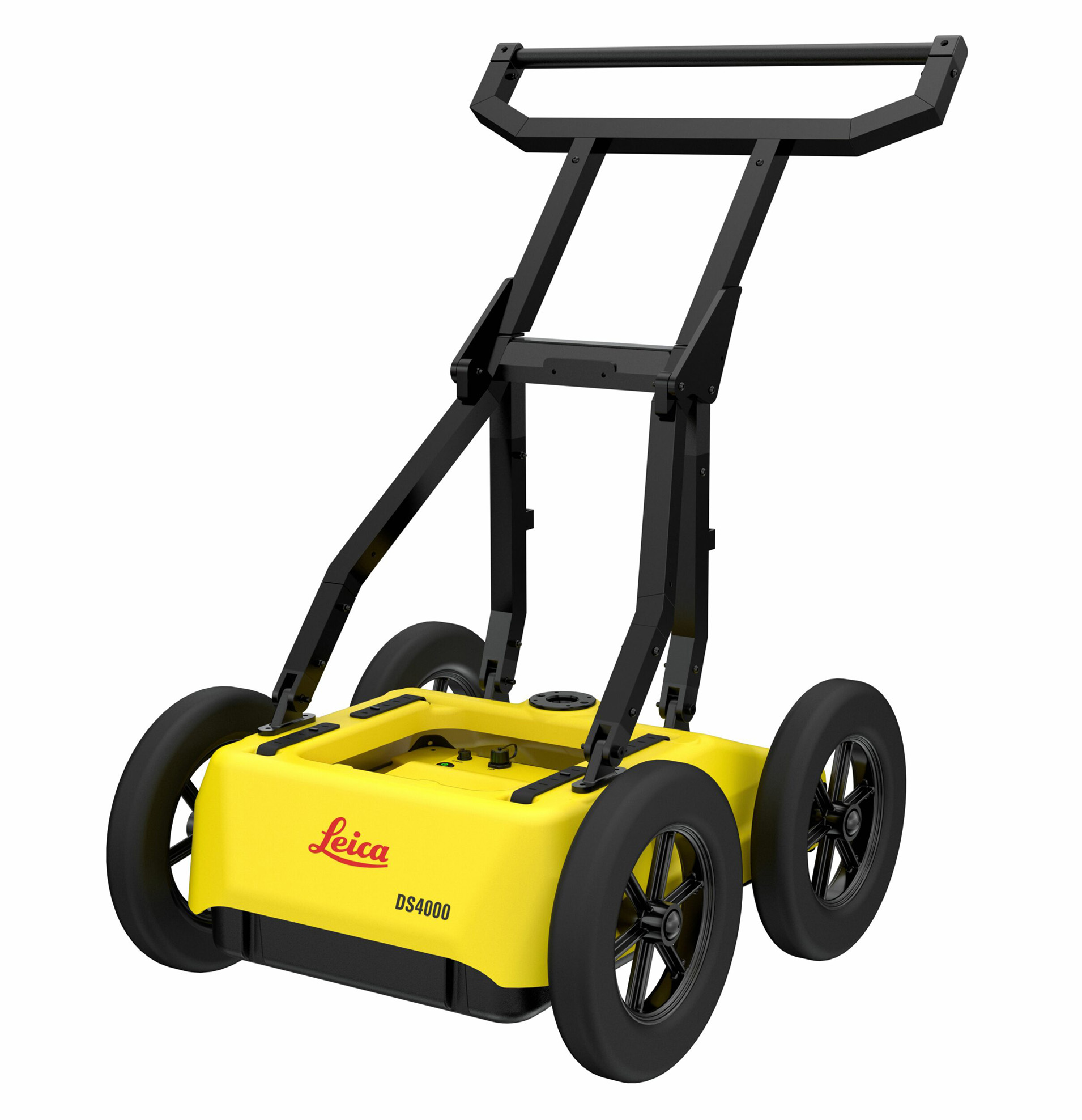
Leica DS4000

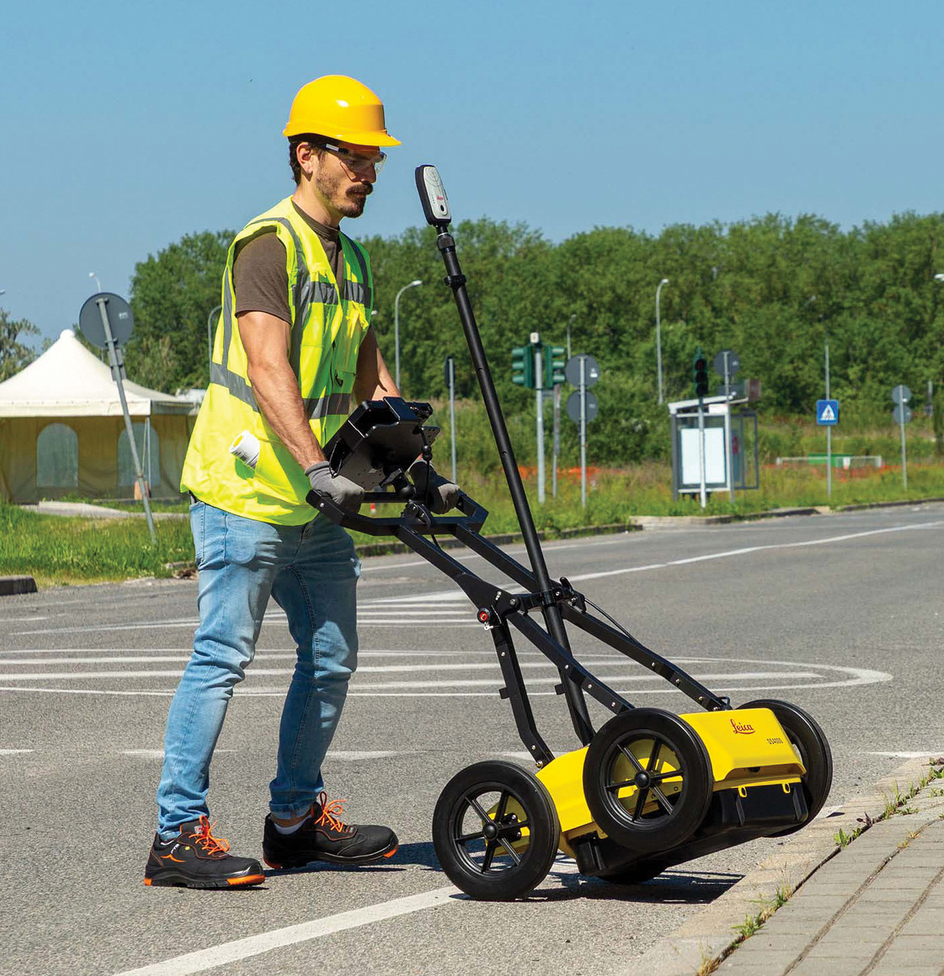
The Leica DS4000 is a dual-antenna ground penetrating radar (GPR) system featuring patented Equalised Scrambling Technology (EsT). It weighs 20 kg (44 lbs), uses dual 200 MHz and 900 MHz frequencies, and measures 750 x 625 x 1000 mm in use.

The Leica DS4000 Utility Detection Radar can identify underground assets up to 60% deeper than traditional systems. By integrating the patented Equalized Scrambling Technology (Est), DS4000 detects underground utilities more clearly at both shallow and deeper levels, revealing all potential threats and difficultly seen underground objects such as fiber optic cables.

Main Features and Benefits

  • See more, reach deeper: EsT patented technology extends your detection range
  • Lightweight (20kg | 44lb), modular and compact design for effortless data collection
  • “Quick Scan Mode” streamlines field operations, saving time and reducing costs
  • uMap, on-field software, allows real time on-site marking and digitalization of detected anomalies
  • Easy switch polarization of the antenna (HH and VV) to ensure an optimal performance
  • Streamline your workflow by creating and finalizing reports directly on-site
  • Channels: 2
  • Central Frequencies: Dual 200 MHz (deep) and 900 MHz (shallow)
  • Inspection Spectrum Range: 80 MHz to 1500 MHz
  • Signal Technology: Patented EsT (Equalised Scrambled Technology)
  • Polarization: HH and VV configuration
  • Dimensions (In Use): 750 x 625 x 1000 mm (30 x 25 x 40 in)
  • Dimensions (Folded): 750 x 625 x 420 mm (30 x 25 x 17 in)
  • Weight: 20 kg (44 lbs)
  • Environmental Rating: IP65
  • Operating Temperature: -20 °C to +50 °C (-4 °F to +122 °F)
  • Vibration & Shock Compliance: IEC 60068-2-64:2012 (vibration); IEC 60068-2-31:2011 (shock)
  • Certifications: CE, UKCA, FCC, IC
  • Wheels: 4 x Ø310 mm / 12 in (default); optional 4 x Ø380 mm / 15 in off-road wheels [1]
 
  • Power Consumption: 16W (acquisition), 12W (stand-by)
  • Operating Time: 4 hours with 1 battery; 8 hours with 2 batteries (supports hot-swap capability)
  • Positioning Support: Encoder, external GPS/GNSS, and Total Station
  • Field Software: uMap (real-time data collection, tomography, and on-site target marking)
  • Processing Software: IQMaps (3D processing with direct AutoCAD export)

RELATED PRODUCTS

REQUEST A QUOTE!