Complete GPR System for Road Inspection and Analysis
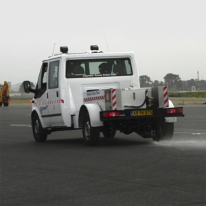
The affordable RoadScan™ system provides users with an effective tool for quickly determining pavement layer thickness. RoadScan is able to collect data densities not obtainable using other labor-intensive methods. RoadScan data can be acquired at highway speeds, which eliminates the need for lane closures and provides a safer working environment.
Rough roads? No problem since GSSI road antennas are air-launched at a height of 18 inches.
Typical Uses
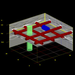
Measuring pavement thickness
Base and sub-base evaluations
Measuring available asphalt prior to milling operations
Integration with FWD
Advantages
Data acquired at highway speeds
No coring required for calibration
Data quality not affected by rough road conditions
Acquire Data
Quick determination of pavement layer thickness
2 GHz antenna provides superior data resolution for measuring lifts as thin as one inch
Multi-channel data collection allows two antennas to be used simultaneously
Deliver Results
ASCII output files for simple data transfer to other software programs